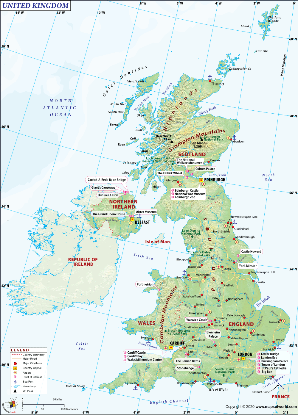
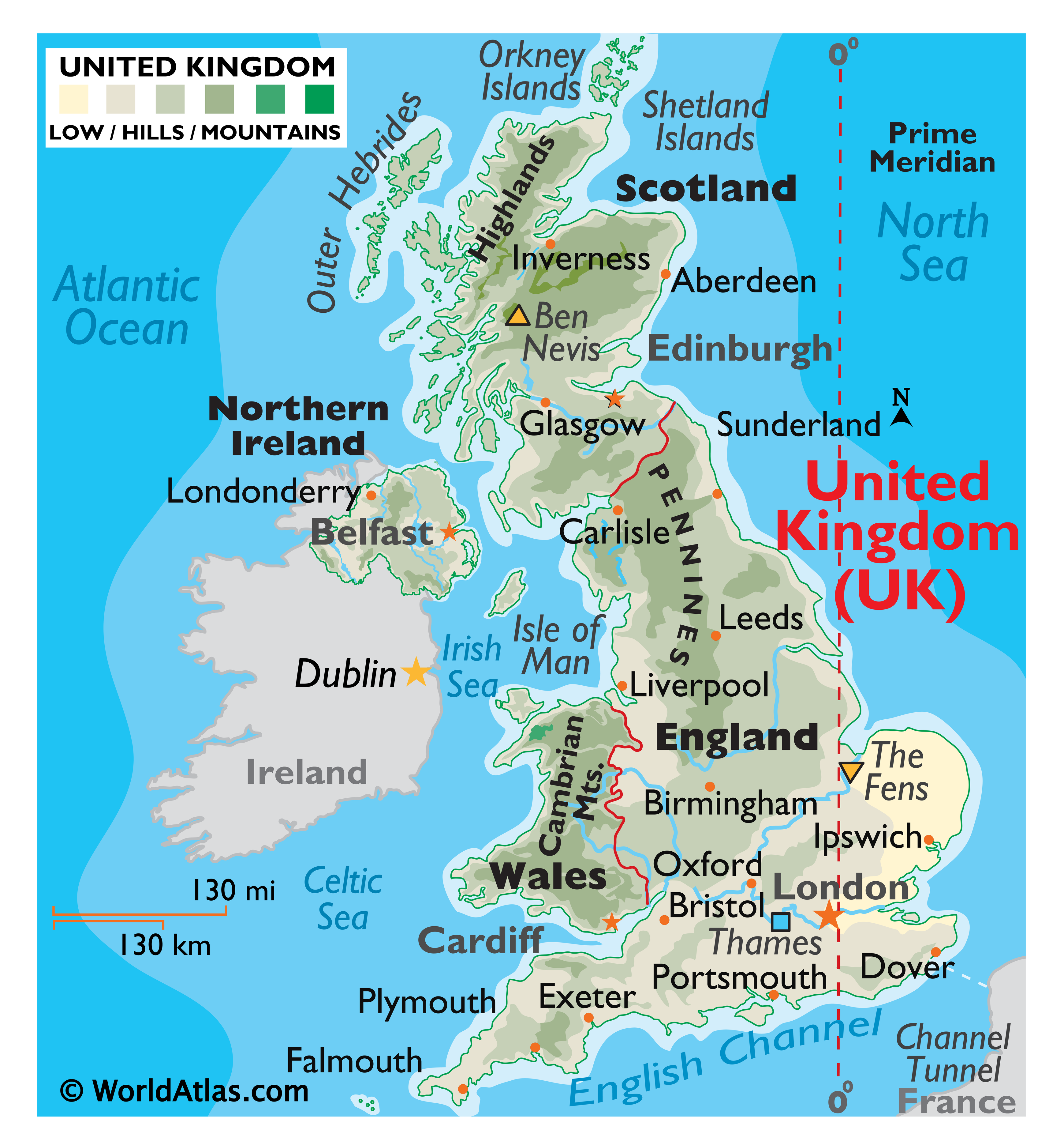
The United Kingdom of Great Britain and Northern Ireland, commonly known as the United Kingdom (UK) or Britain,is a sovereign state in Europe. Lying off the north-western coast of the European mainland, the country includes the island of Great Britain—a term also applied loosely to refer to the whole country—the north-eastern part of the island of Ireland and many smaller islands. Northern Ireland is the only part of the UK that shares a land border with another state (the Republic of Ireland).Apart from this land border, the UK is surrounded by the Atlantic Ocean, with the North Sea to its east, the English Channel to its south and the Celtic Sea to its south-southwest. The Irish Sea lies between Great Britain and Ireland. The UK has an area of 93,800 square miles (243,000 km2), making it the 80th-largest sovereign state in the world and the 11th-largest in Europe.
The United Kingdom is the 22nd-most populous country, with an estimated 64.5 million inhabitants. It is a constitutional monarchy with a parliamentary system of governance. Its capital city is London, an important global city and financial centre with an urban population of 10,310,000, the fourth-largest in Europe and second-largest in the European Union. The current monarch—since 6 February 1952—is Queen Elizabeth II. The UK consists of four countries: England, Scotland, Wales, and Northern Ireland.The latter three have devolved administrations, each with varying powers, based in their capitals, Edinburgh, Cardiff, and Belfast, respectively. The small nearby islands of Guernsey, Jersey, and the Isle of Man are not part of the United Kingdom, being Crown dependencies with the British Government responsible for defence and international representation.