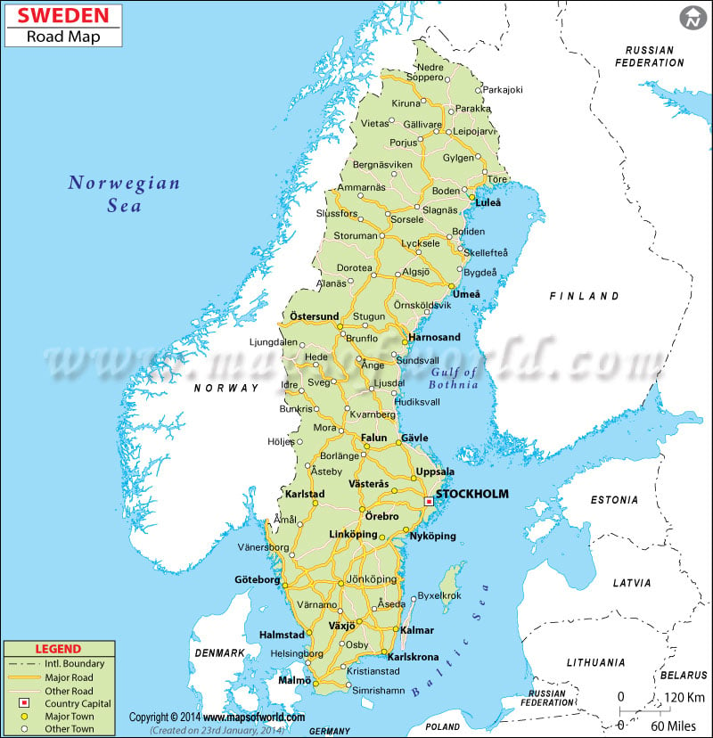
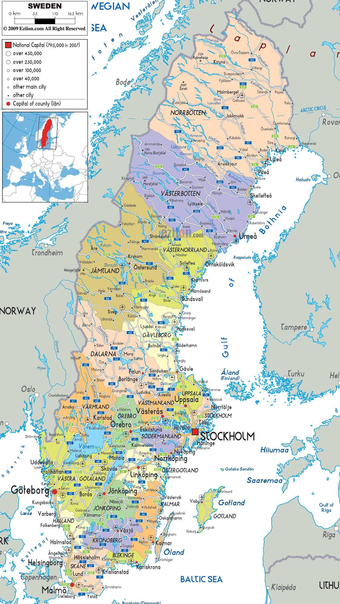
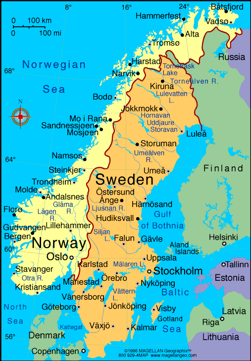
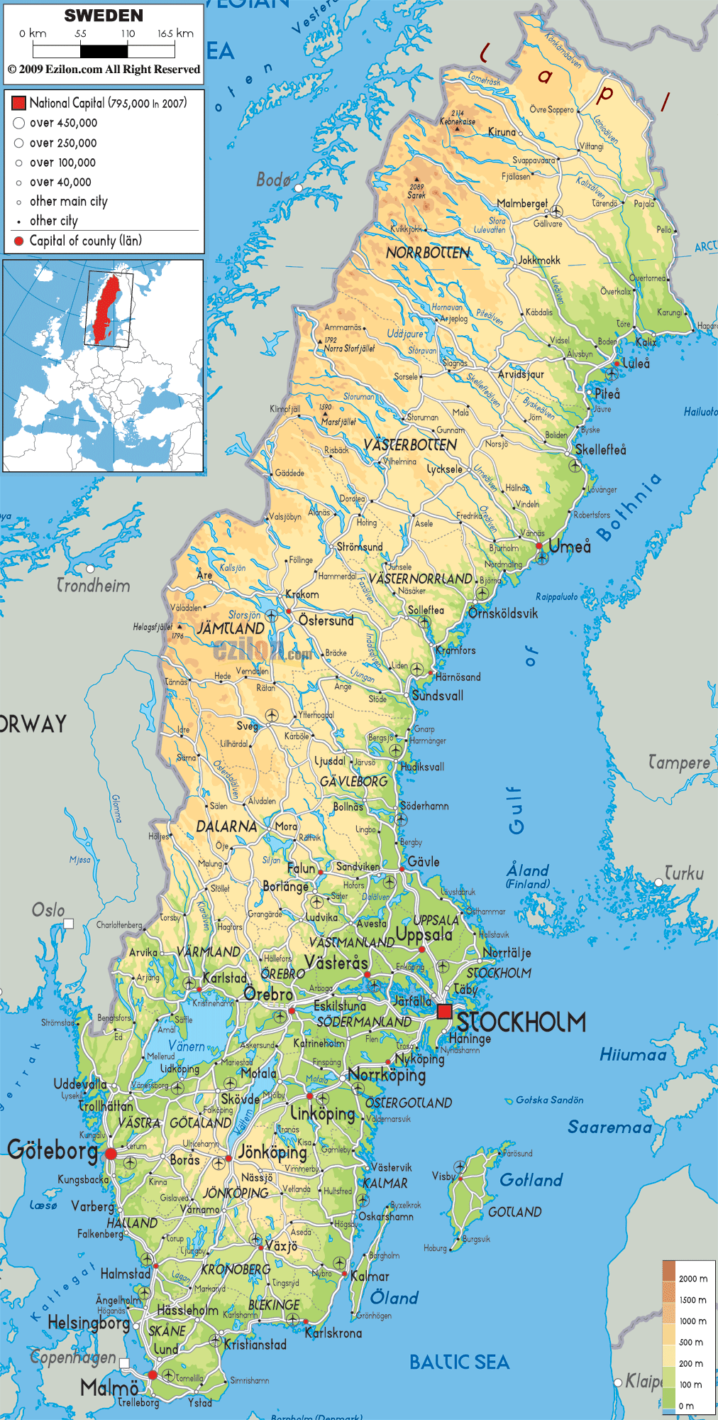
Sweden is a Scandinavian country in Northern Europe. It borders Norway and Finland, and is connected to Denmark by a bridge-tunnel across the Öresund. At 450,295 square kilometres (173,860 sq mi), Sweden is the third-largest country in the European Union by area, with a total population of over 9.7 million. Sweden consequently has a low population density of 21 inhabitants per square kilometre (54/sq mi), with the highest concentration in the southern half of the country. Approximately 85% of the population lives in urban areas.Southern Sweden is predominantly agricultural, while the north is heavily forested. Sweden is part of the geographical area of Fennoscandia.
Germanic peoples have inhabited Sweden since prehistoric times, emerging into history as the Geats/Götar and Swedes/Svear and constituting the sea peoples known as the Norsemen. Sweden emerged as an independent and unified country during the Middle Ages. In the 17th century, it expanded its territories to form the Swedish Empire, which became one of the great powers of Europe until the early 18th century. Swedish territories outside the Scandinavian Peninsula were gradually lost during the 18th and 19th centuries, beginning with the annexation of present-day Finland by Russia in 1809. The last war in which Sweden was directly involved was in 1814, when Norway was militarily forced into personal union.