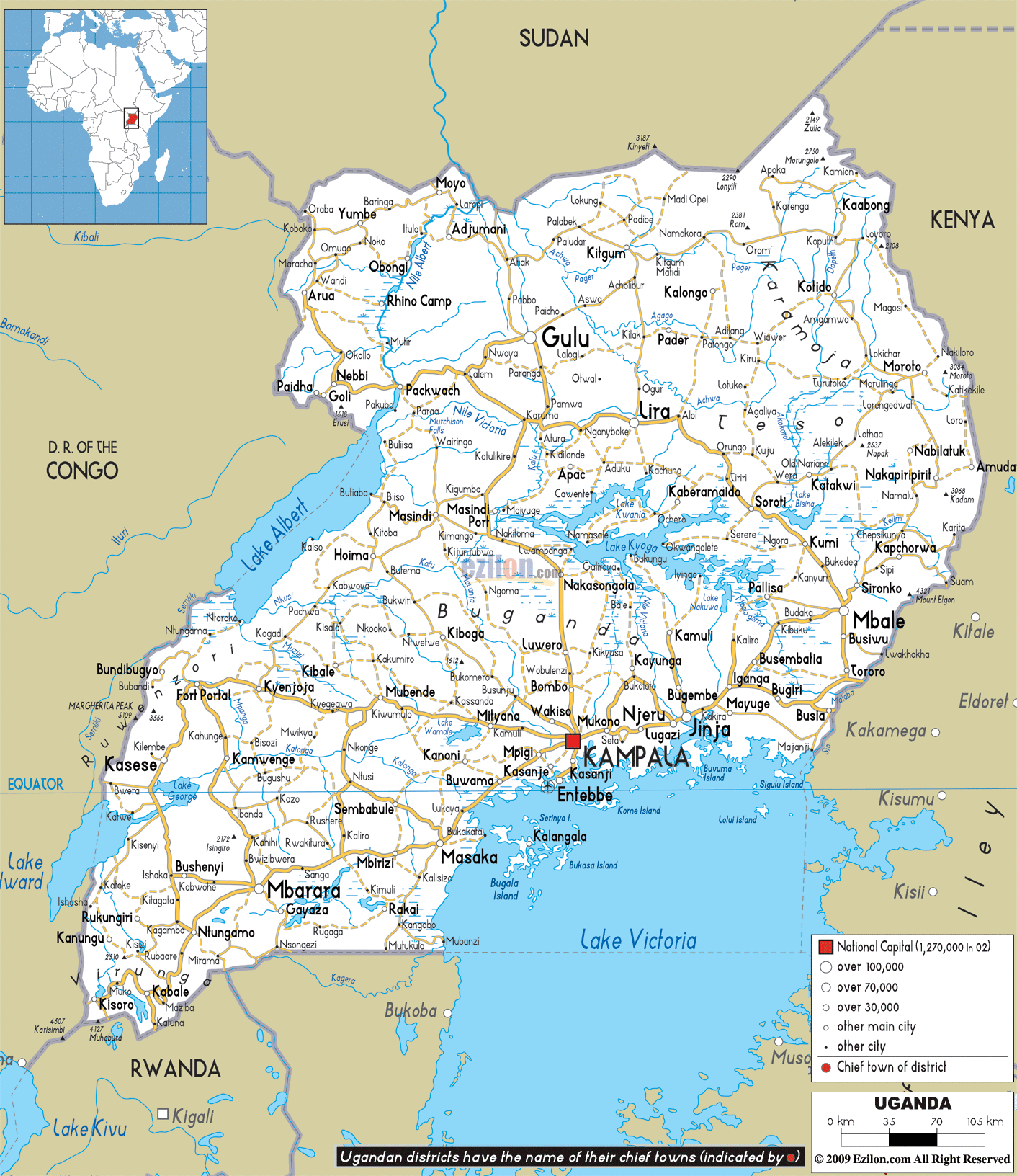
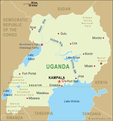
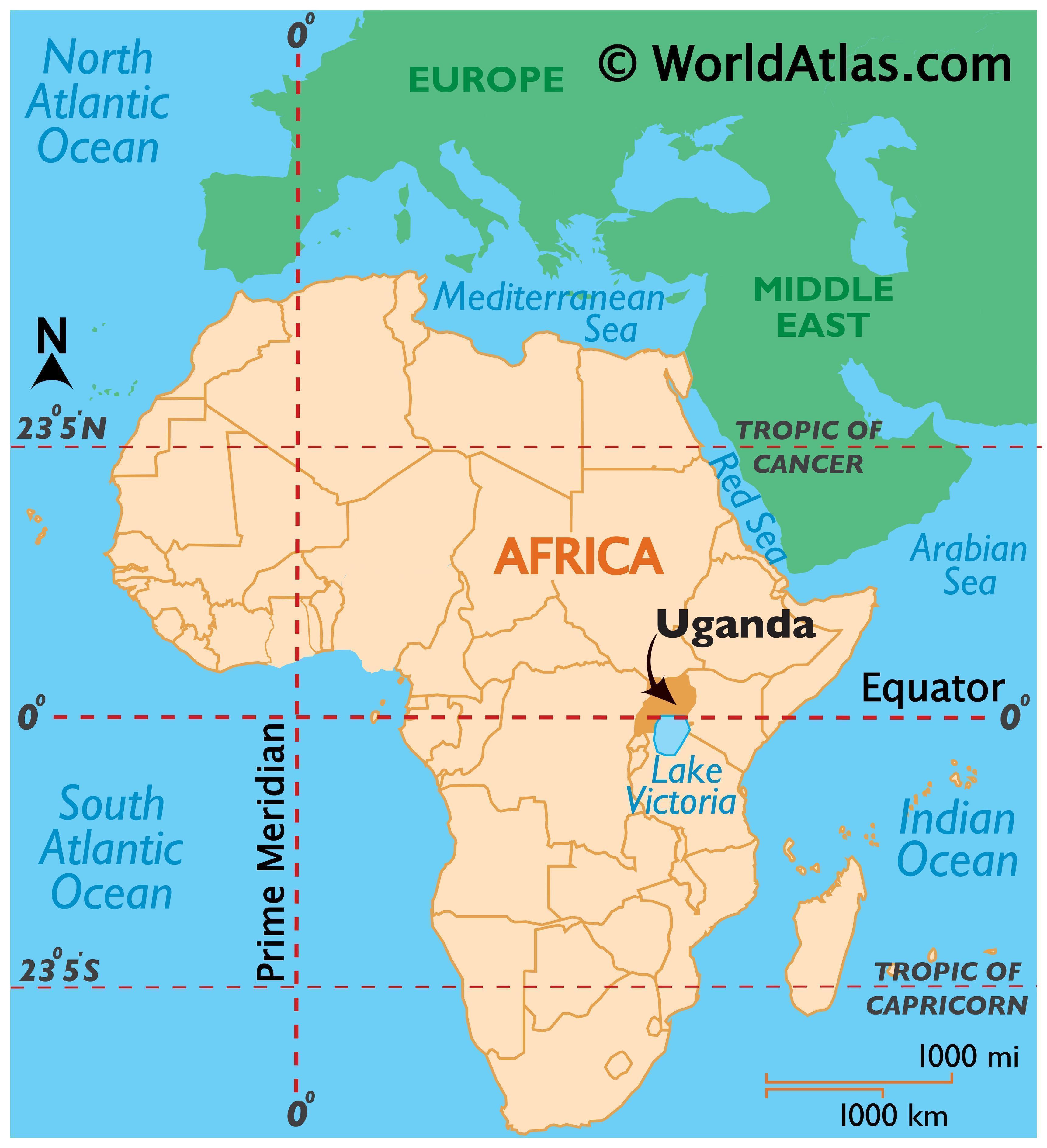
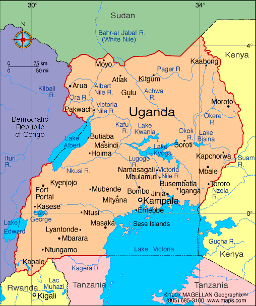
Ugandaofficially the Republic of Uganda, is a landlocked country in East Africa. It is bordered to the east by Kenya, to the north by South Sudan, to the west by the Democratic Republic of the Congo, to the southwest by Rwanda, and to the south by Tanzania. Uganda is the world's second most populous landlocked country after Ethiopia. The southern part of the country includes a substantial portion of Lake Victoria, shared with Kenya and Tanzania, situating the country in the African Great Lakes region. Uganda also lies within the Nile basin, and has a varied but generally a modified equatorial climate.
Uganda takes its name from the Buganda kingdom, which encompasses a large portion of the south of the country including the capital Kampala. The people of Uganda were hunter-gatherers until 1,700 to 2,300 years ago, when Bantu-speaking populations migrated to the southern parts of the country.
Beginning in 1894, the area was ruled as a protectorate by the British, who established administrative law across the territory. Uganda gained independence from Britain on 9 October 1962. The period since then has been marked by intermittent conflicts, most recently a lengthy civil war against the Lord's Resistance Army, which has caused tens of thousands of casualties and displaced more than a million people.
The official languages are Swahili and English. Luganda, a central language, is widely spoken across the country, and multiple other languages are also spoken including Runyoro, Runyankole Rukiga, Langi and many others. The current President of Uganda is Yoweri Kaguta Museveni who came to power in January 1986 after a protracted six-year guerrilla war..