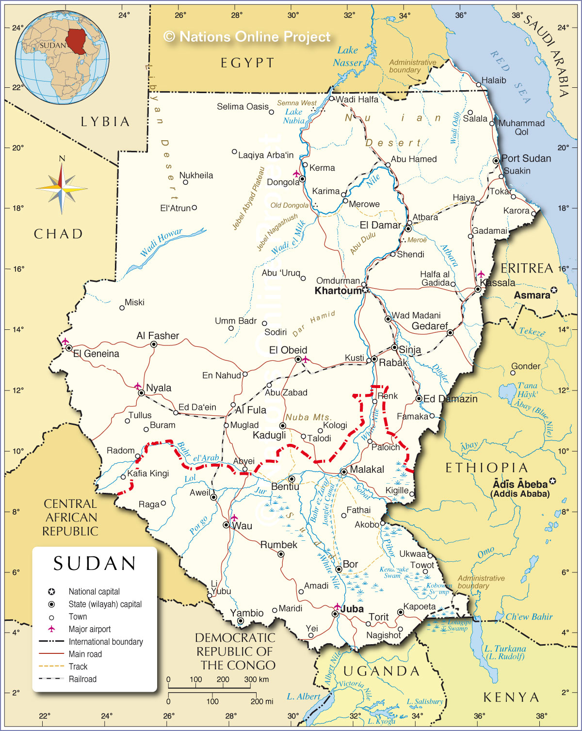
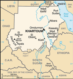
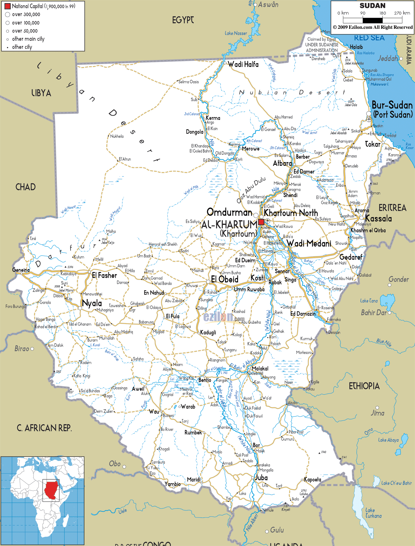
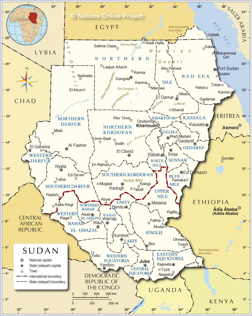
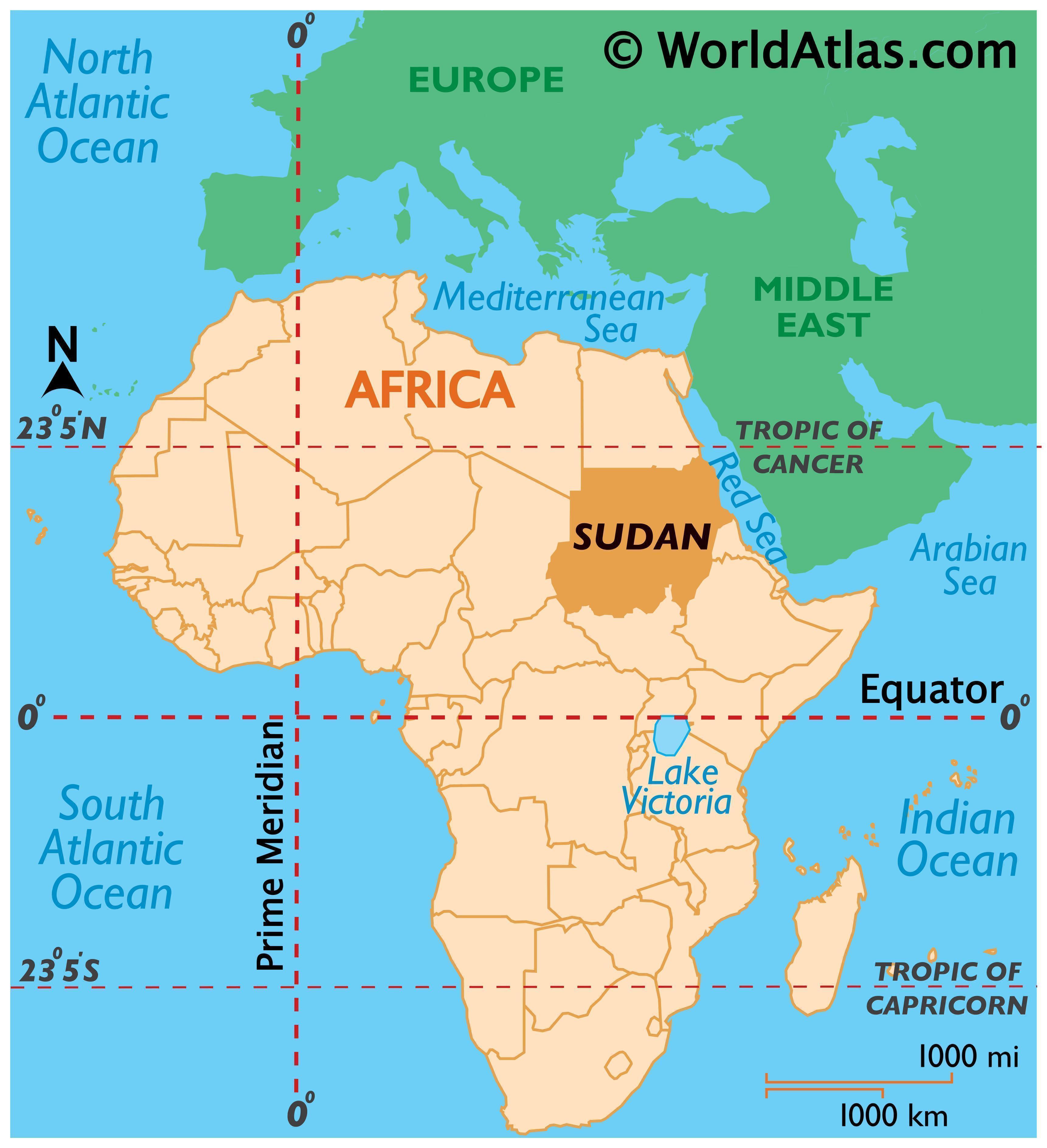
Sudan is an African Country in the Nile Valley of North Africa, bordered by Egypt to the north, the Red Sea, Eritrea, Ethiopia, and Djibouti to the east, South Sudan to the south, the Central African Republic to the southwest, Chad to the west and Libya to the northwest. It is the third largest country in Africa. The River Nile divides the country into eastern and western halves. Its predominant religion is Islam.
Sudan was home to numerous ancient civilizations, such as the Kingdom of Kush, Kerma, Nobatia, Alodia, Makuria, Meroë and others, most of which flourished along the Nile. During the predynastic period Nubia and Nagadan Upper Egypt were identical, simultaneously evolved systems of pharaonic kingship by 3300 BC.By virtue of its proximity to Egypt, the Sudan participated in the wider history of the Near East inasmuch as it was Christianized by the 6th century, and Islamized in the 7th. As a result of Christianization, the Old Nubian language stands as the oldest recorded Nilo-Saharan language (earliest records dating to the 9th century). Sudan was the largest country in Africa and the Arab world until 2011, when South Sudan separated into an independent country, following an independence referendum. Sudan is now the third largest country in Africa (after Algeria and the Democratic Republic of the Congo) and also the third largest country in the Arab world (after Algeria and Saudi Arabia).